JAVASCRIPT, AGOL, EXPERIMENTAL
Data Driven Opacity
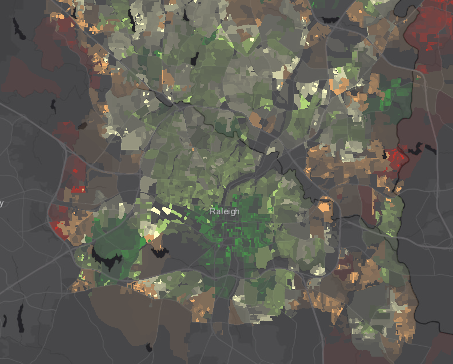
A common issue in the use of choropleth map is that large areas have a large visual weight that is frequently out of proportion with their contribution to the phenomenon under inspection. This simple app is a demonstration of the data-driven opacity capabilities in the ArcGIS JS API 4.x.
GOJAVASCRIPT, GOOGLE, MAPZAP, USEFUL
Raleigh Parks Lookup
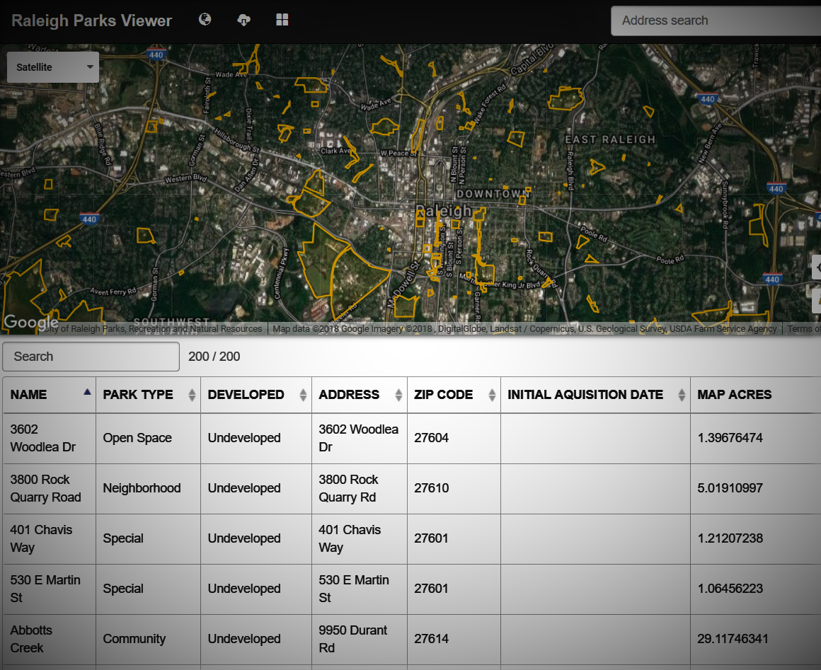
This lightweight tool allows the quick lookup of Raleigh parks and their attributes. Made with Mapzap.
GO
JAVASCRIPT, JQUERY, LEAFLET, ESRI
Raleigh Parks Experiences Lookup
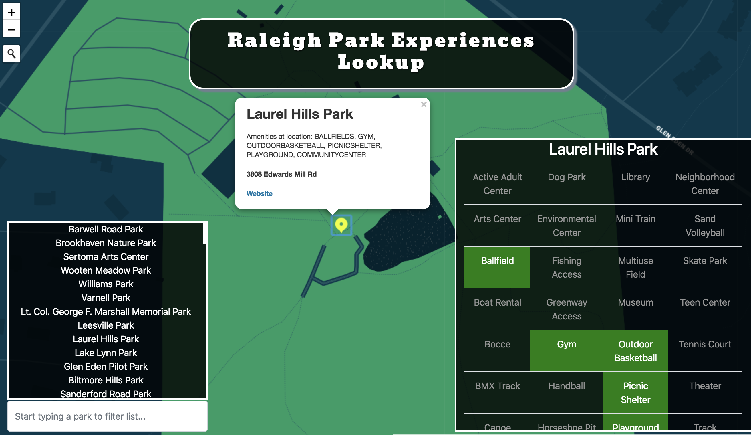
Use jQuery to see which amenities are available at parks - at a glance in tabular form. The original data for park amenities has fields for each experience and states 'Yes' or 'No' if it exists. This map transforms that difficult-to-read table.
GO